Sub-National Benchmarking
Key takeaway
Why this matters
Sub-national benchmarking is one of the EUDR's most technically nuanced provisions. It allows the Commission to assign different risk classifications to different parts of the same country, reflecting the reality that forest conditions and governance quality can vary enormously within large producer countries. For operators with sophisticated traceability systems, sub-national classifications can unlock simplified due diligence for specific regions even within countries that carry an overall standard or high risk classification.
The Legal Basis for Sub-National Classification
Article 29(3) of Regulation (EU) 2023/1115 explicitly authorizes the Commission to classify parts of countries, rather than entire countries, within a particular risk tier. This provision recognizes a fundamental geographic reality: in countries like Brazil, Indonesia, Colombia, or the Democratic Republic of Congo, forest conditions in one region may differ dramatically from those in another.
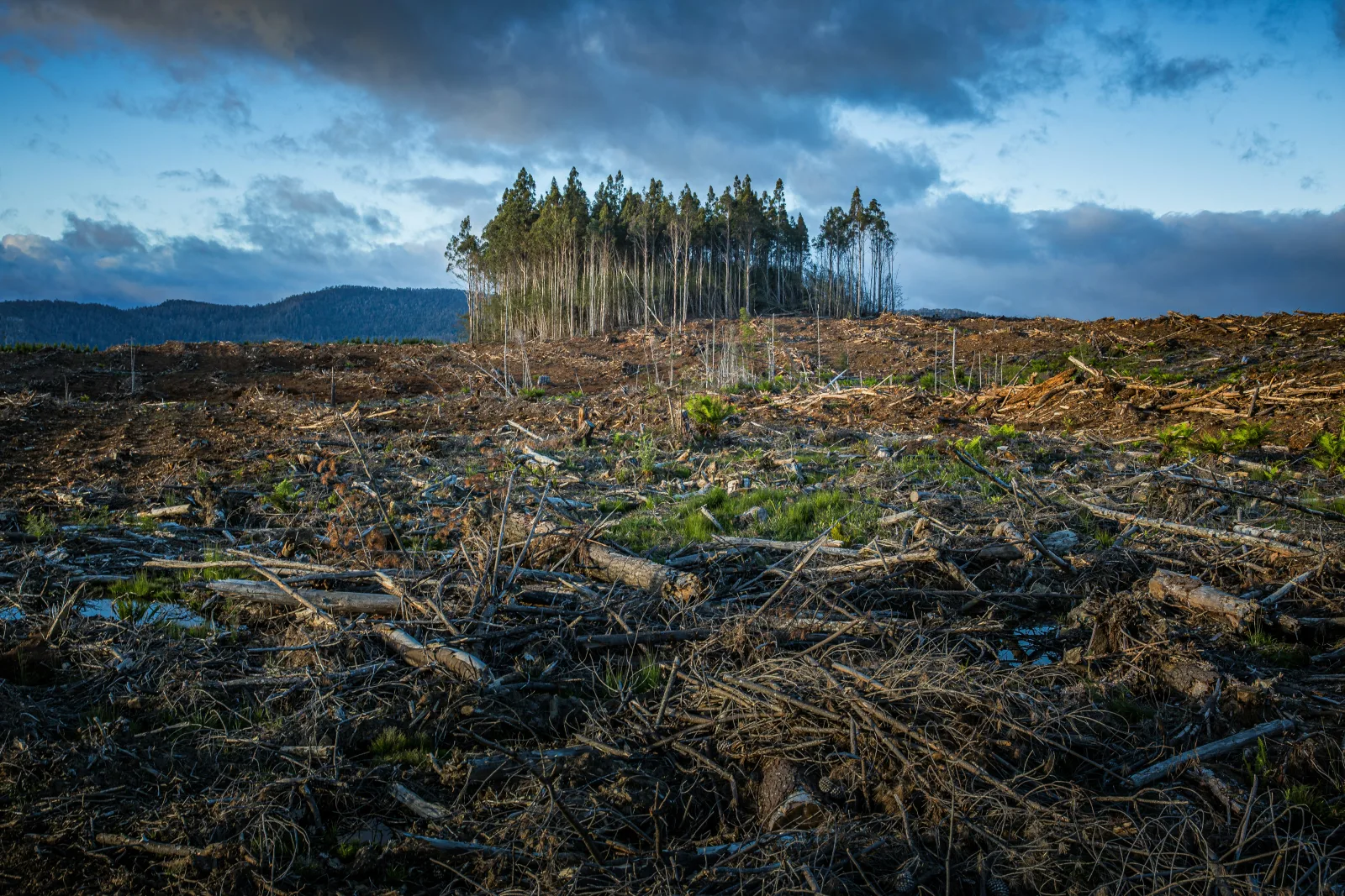
Brazil illustrates this well. The Legal Amazon biome, which has experienced persistently high deforestation rates driven by cattle ranching and soy expansion, presents a very different risk profile from the Pampas grassland region of Rio Grande do Sul, where cattle are raised on natural pasture far from forest frontiers. Applying a single national classification to both regions would either over-burden operators sourcing from genuinely low-risk areas or under-protect operators sourcing from high-risk frontiers.
Analogy
Analogy: Risk Zoning Like Urban Planning
Sub-national benchmarking resembles flood risk zoning in urban planning. A city might lie partly in a high-flood-risk zone near a river and partly on elevated land with minimal flood risk. A uniform policy treating the entire city the same would be both costly and protective of the wrong areas. Sub-national zoning lets regulators, and property buyers, apply appropriate precautions in the right places. Sub-national benchmarking under the EUDR works the same way: directing compliance effort toward genuinely risky production zones rather than applying blanket burdens to entire nations.
How Sub-National Units Are Defined
The Commission can use various administrative and geographic units for sub-national benchmarking. These may include:
- States or provinces: First-level administrative divisions, such as Brazilian states (Pará, Mato Grosso, etc.) or Indonesian provinces (Kalimantan, Sumatra, etc.).
- Municipalities or districts: More granular second-level administrative units, allowing even finer distinctions in risk profiles.
- Biomes or ecological zones: Ecologically defined units such as the Amazon biome, the Cerrado, or the Atlantic Forest, which may cut across administrative boundaries but represent coherent deforestation risk zones.
- Custom geographic polygons: In principle, any geographically defined area with sufficient satellite monitoring data could serve as a sub-national unit.
The choice of sub-national unit involves trade-offs between precision, data availability, and administrative manageability. Finer units offer more targeted classifications but require more granular data to sustain and more complex traceability systems for operators to prove origin at the sub-national level.
Consequences for Traceability Requirements
Sub-national benchmarking has a direct and significant implication for traceability: operators can only benefit from a lower-risk sub-national classification if they can prove, through their documentation and geolocation data, that their products originate from the designated lower-risk zone. This makes the geolocation requirements of Article 9(1)(d) particularly critical in the sub-national context.
Worked example
Example: Soy from Brazil's Cerrado vs. Amazon
Imagine the Commission designates Brazil's Cerrado region in specific states as standard risk, while the Amazon biome receives a high-risk classification. A Brazilian soy exporter supplying EU buyers must demonstrate, through polygon-level geolocation data, that their soy was grown in the Cerrado, not on Amazon-border farmland. Without precise GPS coordinates linked to specific plots, the operator cannot claim the benefit of the lower classification and defaults to the higher risk tier. This creates a powerful incentive for operators to invest in granular, plot-level traceability that goes beyond field-level aggregation.
Benefits and Risks of Sub-National Classification
Sub-national benchmarking serves several important purposes, but it also introduces complexities that operators and producer countries must manage carefully.
| Dimension | Benefits | Risks and Challenges |
|---|---|---|
| For operators | Potential to access simplified due diligence for specific regions even within high-risk countries | Requires plot-level geolocation accuracy; risk of misclassifying origin if supply chains are not fully transparent |
| For producer countries | Rewards governance investments in specific regions; creates differentiation within country; reduces economic impact | Requires comprehensive sub-national data systems; administrative burden to maintain regional designations |
| For enforcement | More targeted use of inspection resources; focuses scrutiny on genuinely high-risk zones | Verification of sub-national origin claims requires cross-referencing geolocation data with classification boundaries |
| For forests | Directs deforestation pressure away from classified high-risk zones; protects priority conservation areas | Risk of "displacement": operators may shift sourcing to lower-risk sub-national areas, displacing deforestation pressure to unregulated areas |
Displacement Risk: A Key Concern
One of the most important challenges raised by environmental analysts regarding sub-national benchmarking is the risk of deforestation displacement. If producers in a high-risk zone shift their activities to a lower-risk zone to benefit from reduced EUDR scrutiny, the regulation may simply relocate deforestation rather than reduce it overall.
Addressing displacement risk requires monitoring systems that track deforestation trends in both classified zones and adjacent areas. If a low-risk sub-national designation is followed by increased deforestation in neighboring unclassified or differently classified areas, the Commission should be able to detect this through the EU Observatory's monitoring data and revise classifications accordingly. This feedback loop is essential to the integrity of the sub-national benchmarking approach.
Country Engagement in Sub-National Classification
Producer countries play an active role in shaping sub-national classifications. Through bilateral dialogues with the Commission, they can present evidence of strong governance in specific regions, robust deforestation monitoring systems, and effective legal enforcement. Countries that proactively engage in this process and provide high-quality geospatial data are better positioned to secure favorable sub-national designations for their low-risk production areas.
This dynamic encourages producer countries to invest in regional forest monitoring infrastructure, strengthen sub-national governance, and build the data systems needed to support both EUDR compliance and their own classification requests. International development programs, including EU-funded cooperation, can play a role in supporting this capacity building.
Sub-national benchmarking depends fundamentally on high-resolution satellite monitoring. The EU's Copernicus Earth Observation Programme provides satellite imagery that can detect forest cover changes at fine spatial scales, enabling the Commission to track deforestation trends at the level of individual provinces or municipalities. Global Forest Watch, which uses Landsat and Sentinel satellite data, provides publicly accessible tree cover loss data at 30-meter resolution globally. These data sources support not only initial classification decisions but ongoing monitoring for reclassification. As satellite monitoring technology improves (higher temporal resolution, better cloud penetration through SAR data), sub-national classifications are likely to become increasingly precise and dynamically updated.
Key Takeaways
- Article 29(3) allows the Commission to assign different risk classifications to parts of a country, reflecting regional variation in forest conditions and governance
- Sub-national classifications can use administrative units (states, provinces), ecological zones (biomes), or custom geographic polygons
- Operators can only benefit from a lower-risk sub-national designation if their traceability systems can prove origin at the required geographic precision
- Sub-national benchmarking raises displacement risk: production may shift to lower-risk zones rather than deforestation being eliminated
- Producer countries can actively engage with the Commission to present evidence supporting favorable sub-national designations for well-governed regions
Knowledge Check
Test what you just learned
3 questions · check each one as you go
Which article of the EUDR authorizes the Commission to classify parts of countries differently from the national classification?
What is 'deforestation displacement' in the context of sub-national benchmarking?
What is required for an operator to benefit from a lower-risk sub-national classification within a standard-risk country?